
Key Takeaways
- Autonomous driving depends on a continuous cycle of sensing, interpreting, predicting, planning, and controlling.
- No single sensor can reliably understand every road condition, so systems commonly combine cameras, radar, LiDAR, and positioning tools.
- Safe driving requires more than detecting objects. The vehicle must estimate how people, bicycles, and other vehicles might move next.
- Automation has limits, which is why testing, fallback behavior, cybersecurity, and clear operating boundaries matter.
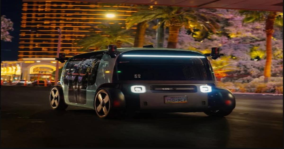
A human driver approaching a crosswalk notices the signal, checks for people near the curb, watches surrounding traffic, and decides whether to slow down. An autonomous vehicle performs a similar sequence, but it must repeat it constantly through sensors, software, and vehicle controls. To learn how self-driving cars work, it helps to view the vehicle as a decision-making system rather than a single piece of technology. It collects information about the road, turns that information into a live model of the environment, and chooses a cautious action based on its observations.
What Makes a Vehicle Autonomous?
Driver-assistance features and autonomous driving systems are not the same thing. Lane centering, adaptive cruise control, and emergency braking can support a driver, but they do not necessarily remove the driver’s responsibility to supervise the road. Higher levels of automation may handle the driving task within a defined operational design domain, such as a limited service area, a specific road type, a speed range, or weather conditions. For consumers, the distinction matters. Current federal automation guidance states that even the highest level of automation available in consumer vehicles still requires a fully engaged driver. At the same time, higher-level automated driving systems are designed for limited conditions rather than for universal use on every road.
The Sensor Suite: How the Vehicle Sees the Road
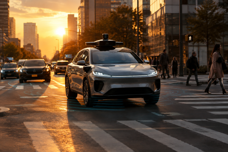
Autonomous vehicles typically use several sensor types because each one contributes different evidence. Cameras capture color, traffic signals, road markings, signs, vehicle shapes, and human gestures. Radar estimates the distance and relative speed of objects, including in conditions that reduce visual clarity. LiDAR uses reflected light pulses to create detailed three-dimensional measurements of nearby surroundings. Ultrasonic sensors can help at close range during parking or low-speed maneuvers. Positioning systems also help the vehicle estimate its location, but tunnels, tall buildings, and other obstructions can weaken location signals. For that reason, position estimates are checked against lane markings, roadside features, maps, and live sensor observations.
Sensor Fusion and Localization
Sensor fusion combines incoming signals into a single, coherent picture of the road. A camera may identify a person, LiDAR may estimate that person’s position, and radar may help measure relative movement. When multiple inputs support the same conclusion, the system can have greater confidence. When they disagree, the software may slow down, collect more evidence, or choose a lower-risk response. Timing and calibration are essential. If a sensor reading is delayed or misaligned, the vehicle could incorrectly place an object in the road scene.
Localization has a similar challenge. Maps provide useful context on lanes, intersections, and road geometry. Still, live perception must account for construction barriers, altered lane patterns, and other changes that may not appear in map data.
Perception, Prediction, and Planning
Perception software identifies objects and road conditions. It estimates whether an object is a car, truck, bicycle, pedestrian, animal, traffic cone, emergency vehicle, or debris. It also considers size, speed, direction, distance, and whether the object could enter the vehicle’s path. Detection alone is not enough. Prediction estimates several possible next movements. A cyclist may move around a parked car. A pedestrian near a curb may remain still, begin crossing, or step back. A nearby vehicle may merge unexpectedly.
Instead of treating a single future outcome as certain, the system evaluates possible paths and prepares for the riskier, more reasonable scenarios. Planning then selects an action that follows road rules while maintaining safety margins. The vehicle may continue, reduce speed before a crosswalk, wait for a traffic gap, change lanes around an obstruction, or stop when the situation is unclear. The safest choice is not always the fastest one.
Control: Turning a Plan into Motion
Once a path is selected, the control system converts it into steering, braking, and acceleration commands. Feedback from the vehicle and its sensors helps correct small differences between the planned path and actual movement. For example, if a curve requires a slower speed than expected, the system can adjust braking and steering rather than rigidly following an earlier command.
Handling Uncertainty and Explaining Decisions
Roads create uncertainty through rain, glare, fog, damaged lane markings, unusual objects, construction, emergency scenes, and unpredictable human behavior. A system that detects lower confidence should respond conservatively by increasing following distance, avoiding a questionable lane change, reducing speed, or stopping in a safe location when it cannot continue reliably. Engineers also need to understand why an automated vehicle acted as it did. Research into more understandable vehicle decisions can help teams investigate unexpected braking, missed detections, or poor responses around cyclists and emergency vehicles. Explainability supports better testing and helps safety operators recognize potential problems sooner.
Testing, Hard Cases, and Cybersecurity
Before deployment, developers use simulation, closed-course testing, public-road testing, and detailed event review. Simulation can expose a system to many unusual scenarios, while controlled tracks allow repeatable tests. Real-road operations reveal changing traffic behavior and road conditions that are difficult to reproduce perfectly elsewhere. Hard cases deserve special attention: heavy weather, darkness, temporary traffic control, missing road paint, sensor blockage, and sudden changes in lane layout. Connected vehicles must also protect software updates, communication systems, location data, and sensor information from unauthorized access. Safety functions should remain available even if a network connection is lost.
Common Questions About Autonomous Vehicles
Can autonomous vehicles see better than people?
They can monitor multiple directions and measure some details quickly, but they can also struggle with unusual or ambiguous scenes. Performance depends on the sensors, software, testing, and operating conditions.
Do they need maps?
Maps provide useful context, but live sensors remain necessary to detect people, obstacles, changed lanes, and temporary road conditions.
Can they drive anywhere?
No. A system designed for a particular service area or operating condition differs from full automation across all roads, weather, and traffic conditions.
Conclusion: Safe Driving Starts With Better Decisions
Autonomous driving is a continuous loop of decision-making rather than the result of a single breakthrough sensor or software model. To navigate safely, a vehicle must constantly sense its surroundings, interpret available information, recognize uncertainty, predict what nearby road users may do, choose an appropriate path, and control its movement with precision. Each stage depends on the others, and even a small error in recognizing an object or estimating its movement can affect the decisions that follow.
This process becomes more demanding in busy urban environments, where pedestrians, cyclists, changing traffic signals, construction zones, and unexpected obstacles can create unpredictable situations. The system must also adjust when road conditions differ from digital maps or when weather and visibility affect sensor performance. The most meaningful measure of progress is therefore not simply how advanced the technology appears, but whether it can make consistent, careful, and explainable decisions when ordinary roads become difficult.
Read more articles from TechTrendery